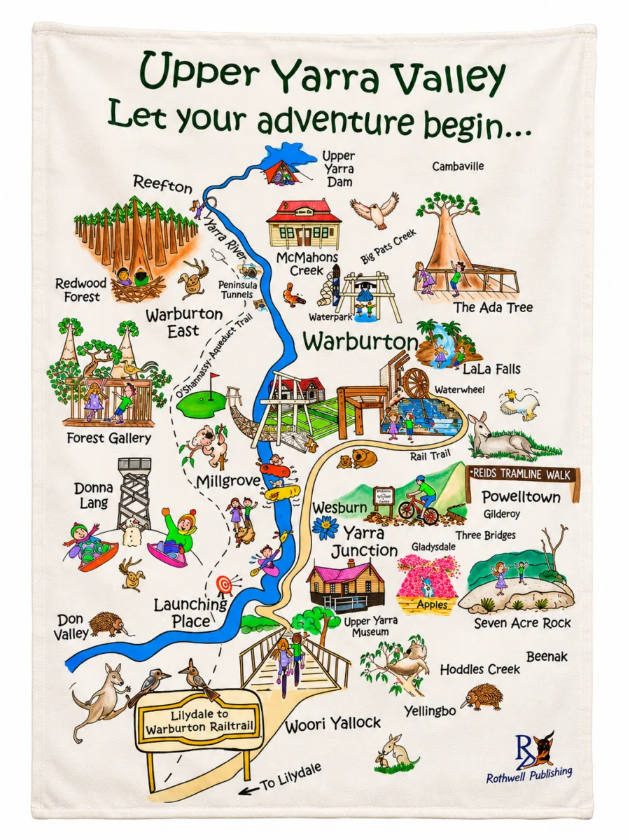
An illustrated map of the Upper Yarra Valley. Let your adventure begin!
This tea towel features a colourful, hand-drawn map of the Upper Yarra Valley, from the Upper Yarra Dam and Reefton down through Warburton, McMahons Creek, Millgrove, Wesburn, Yarra Junction, Launching Place and Woori Yallock, along the Lilydale to Warburton Rail Trail.
Look closely to spot local landmarks including the Redwood Forest, the Ada Tree, LaLa Falls and plenty of local wildlife.
Product Highlights:
- Illustrated map of the Upper Yarra Valley
- Local towns, landmarks and wildlife
- Follows the Lilydale to Warburton Rail Trail
- A great souvenir, gift or wall hanging
- From Rothwell Publishing
Upper Yarra Valley: let your adventure begin…